
What is Orienteering?
A “Thinking Sport” that fuses map reading, decision-making, and movement. Athletes race against time, using a map and compass to locate control points while navigating and strategising their route in an unfamiliar terrain.
Where Education Meets Adventure
Backed by research studies published in
Cambridge Journal of Education (JoVE)
Perceptual & Motor Skills Journal – King’s College London
Archives of Gerontology & Geriatrics – Elsevier Ireland
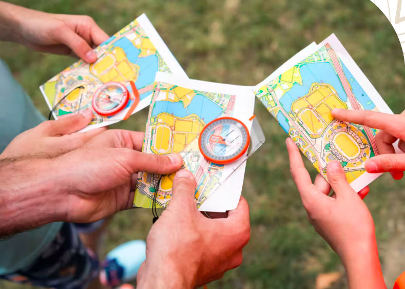
Unlike other sports, orienteering isn’t just about speed—it’s about strategy, observation, and decision-making. Every course is a puzzle, and you’re the solver! That's where it gets it's name from: THE THINKING SPORT

A Global Sport - cultivating smarter generations, celebrated in The World Games


Recognized by the International University Sports Federation (FISU)
Recognized by the International Olympic Committee (IOC)
A 100-year-old Sport originated in Sweden, now having presence Globally.
Foot - O
The classic form—run, jog, or walk as you navigate.
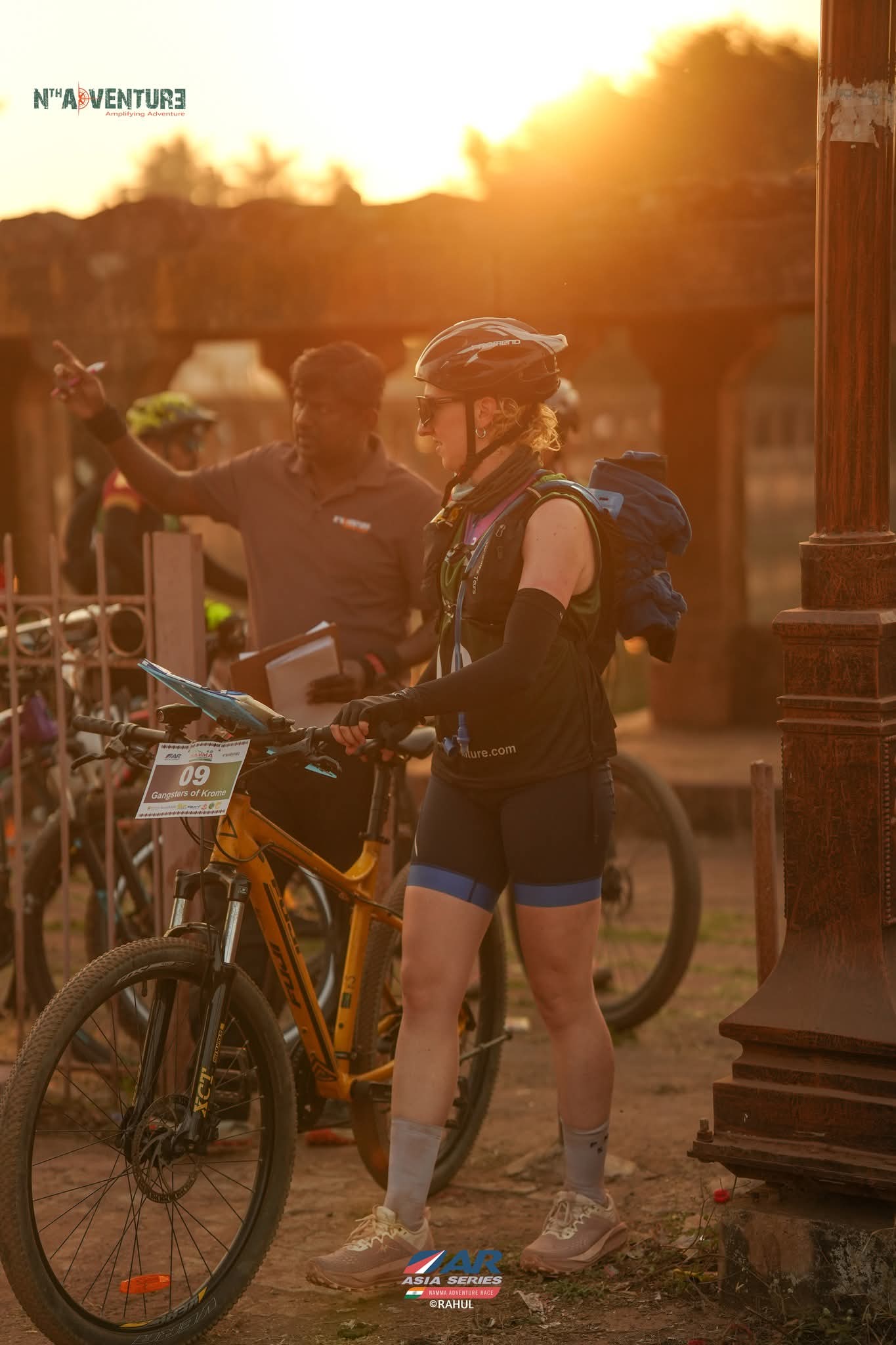
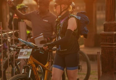
MTB - O
Tackle trails and tracks on two wheels while Orienteering.
Types Of Orienteering
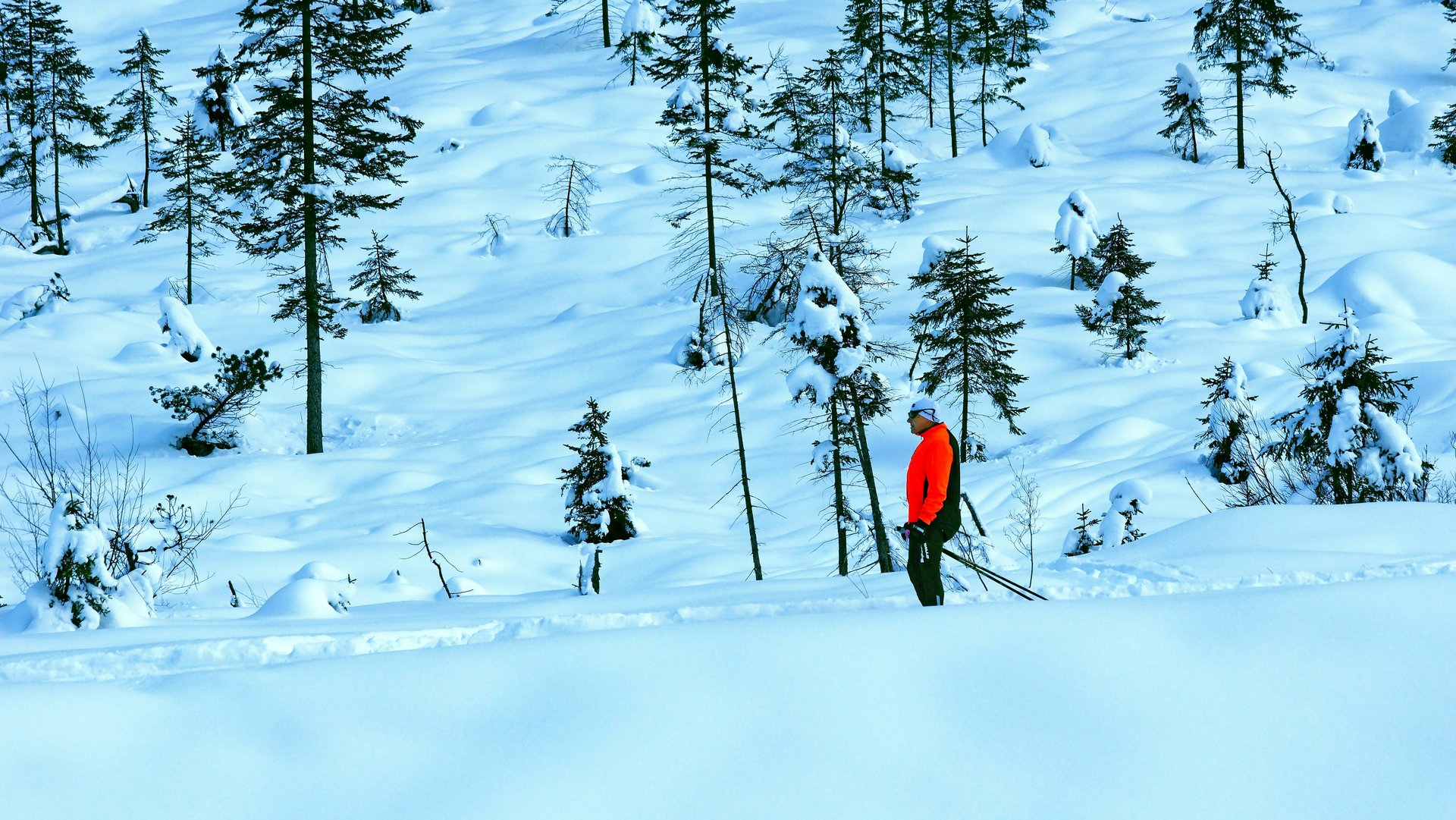
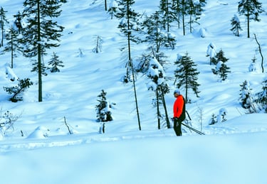
Ski - O
An endurance winter sport combining navigation and cross-country skiing.
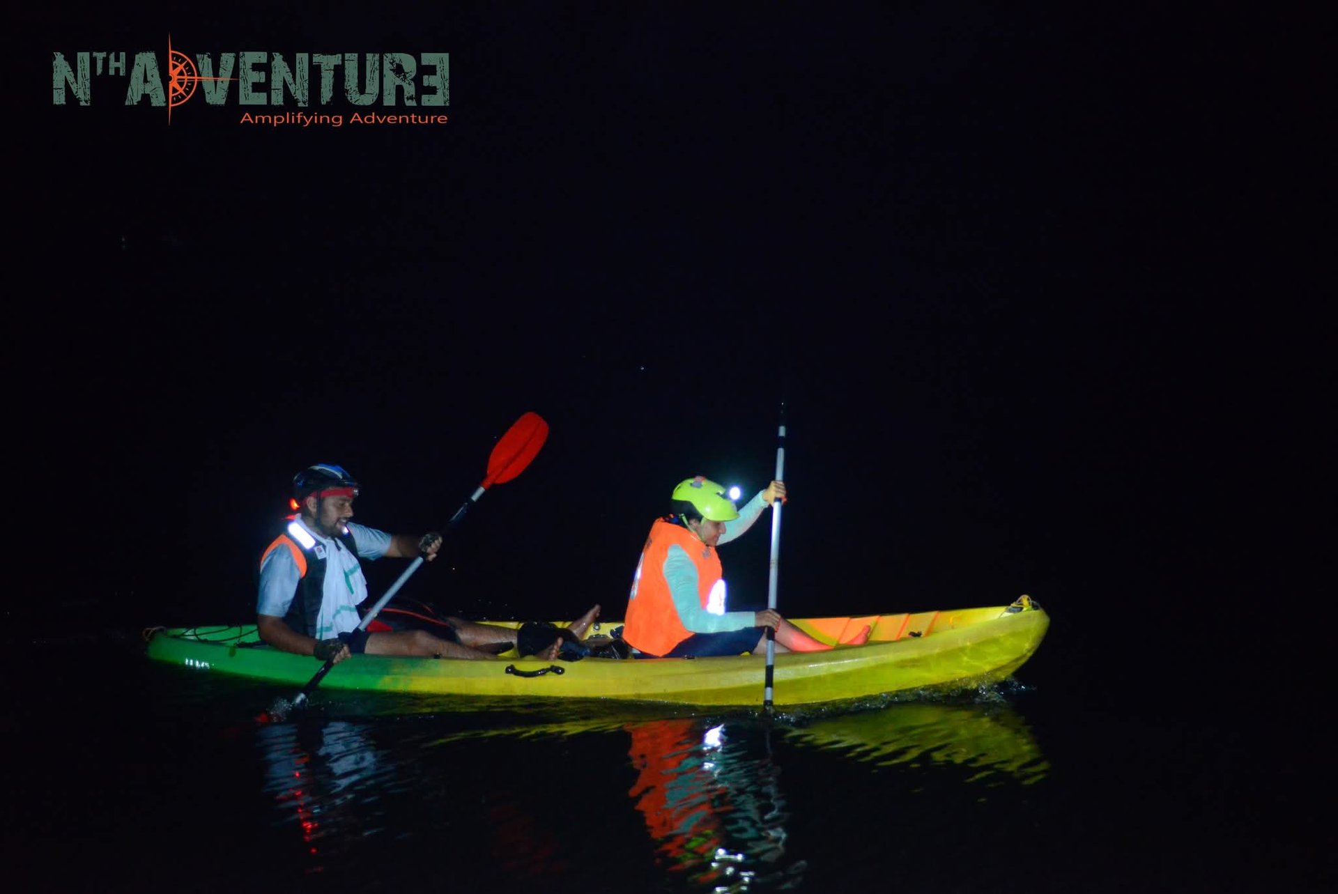
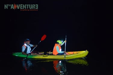
Kayak - O
Paddle your way to each checkpoint on rivers or lakes.
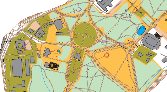
The Orienteering Map
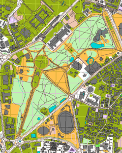
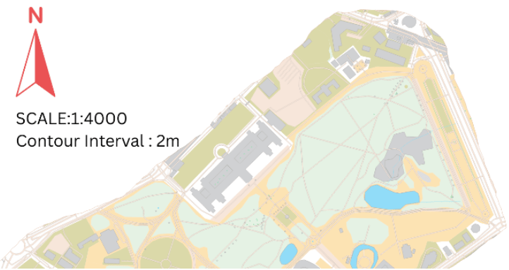
To a beginner, the orienteering map looks like a splash of color. Once you learn the "code," the colors become your best friend, telling you exactly what the ground feels like beneath your feet and what to expect next.
Orienteering maps are unique in their design. Unlike standard road maps, they are incredibly detailed, showing every boulder, path, and depression that might affect your route choice. They use bigger scales than typical Survey of India maps or google navigation maps, packing in fine terrain details through a variety of symbols. Beginners don't need to memorize them all upfront, but focus on basics like paths and tracks, walls and fences, plus blue symbols for water features such as streams or ditches (also beginner maps shows a legend for reference).
The easiest starting point is the colors: yellow marks open land, white shows runnable forest, light green indicates slightly denser woods, and darker greens signal thicker vegetation. A full legend is usually included on most maps to make everything clear.
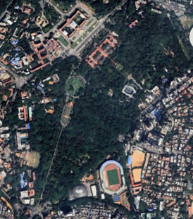
SATELLITE MAP
ORIENTEERING MAP
Finding North
In orienteering, we don't worry about "True North"; we care about Magnetic North.
Blue/Black North Lines: Orienteering maps have vertical lines drawn across them pointing to Magnetic North.
The Goal: You "orient" your map by turning it until the north lines on the map align with the red needle of your compass. Once aligned, what is in front of you on the map is physically in front of you on the ground.
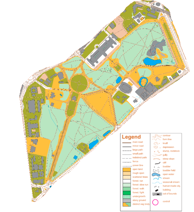
Legend
The Legend is the map’s essential "translator," converting a colorful grid of lines and shapes into recognizable terrain features.
In orienteering, the legend follows a universal international standard (IOF), ensuring that symbols for things like a knoll, a cliff, or a seasonal marsh are the same regardless of what country you are in.
It uses a specific color-coding system—where brown represents landforms, black indicates man-made or rock features, and green shows the thickness of vegetation—to tell you not just what is there, but how fast you can run through it. For a navigator, the legend is the key to "seeing" the forest before they even arrive, turning abstract symbols into a clear mental picture of the path ahead.
Legend Color (Quick Guide)
White: Open forest (easy to run).
Green: Thick brush (slower to run; the darker the green, the thicker the "fight").
Yellow: Open land, like a field or meadow.
Blue: Water features (lakes, pits, or streams).
Black: Man-made objects (paths, fences, buildings) and rocks.
Brown: Elevation features (contour lines, hills, gullies).
Quick Tips for Beginners
The "Green" Rule: If you see dark green on the map, look for a way around it—it’s usually too thick to run through!
Follow the Black: For beginners, "handrails" (black lines like paths and fences) are your best friend for navigating safely.
The Brown Lines: The closer the brown contour lines are to each other, the steeper the hill.

Scale - The Real World Ruler
Imagine you are looking at the ground from a drone. An orienteering map is a "large-scale" view, which means it zooms in much closer than a standard hiking map. While a typical map might show a whole mountain range, an orienteering map zooms in to show you every individual boulder, tree, and building.
How the "Scale" Works
The scale is just a simple rule for measuring distance. It tells you how many "real" centimeters are hidden inside every 1 cm on your map.
Example (1:7,500 scale): * 1 cm on the map = 7,500 cm in the real world.
To make it easier: 1 cm on the map = 75 meters on the ground.
Fun Fact: Because things like small rocks or tiny pits are so important for finding your way, map makers often draw them slightly larger than they actually are. This makes them "pop" so you don't miss them while you’re running!
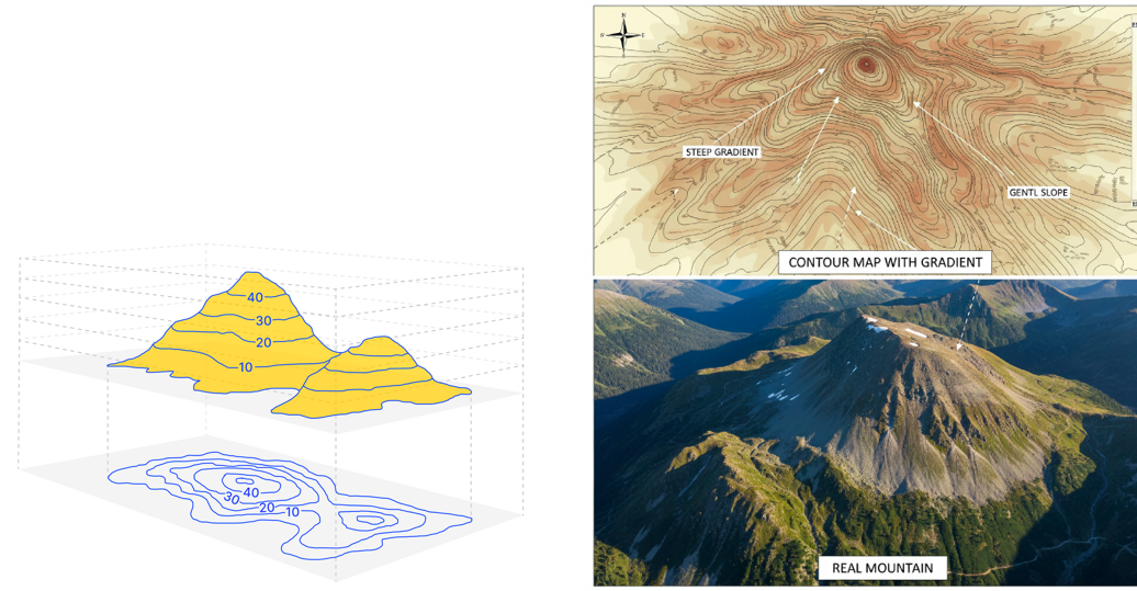
Understanding Contours
Contours are the most vital part of the map for an orienteer. They are the brown lines that show the shape and height of the land.
Closer lines mean the terrain is very steep.
Wider lines indicate a gentle slope or flat ground.
Learning to "read" the shape of the hill from these lines allows a runner to visualize the 3D terrain while looking at a 2D piece of paper.
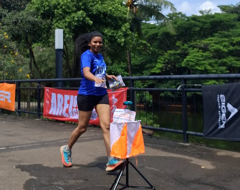
Control Points and "The Punch"
You can't have orienteering without the targets.
The Flag: A three-sided orange and white silk kite marks the spot.
The Control Description: A small sheet of paper (often using symbolic icons) that tells you exactly where the flag is (e.g., "The east side of the big boulder").
The Electronic Punch: Most modern races use an "e-stick" or "finger-chip" that you dip into a station at the flag to prove you were there and to record your split times.
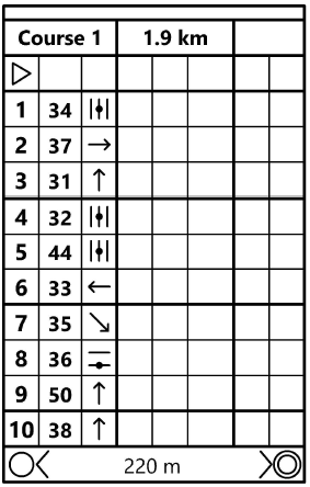
Course Walk through: What to Expect
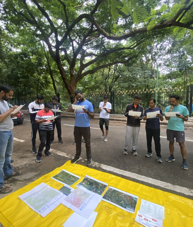
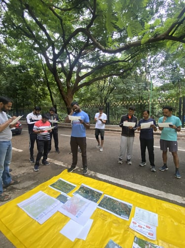
From Start to Finish, here is the flow of an event:
The Start: You receive your map and your "e-punch" (electronic timing finger-chip).
Triangle on the map means the start point for the race.
The Planning: You have seconds to study the map and choose your first route.
The Navigation: You visit a series of "Control Points" (marked by orange and white flags) in a specific order as defined in the map.
The Punch: At each flag, you "dip" your chip into a station to record your split-time.
The Finish: You cross the line and receive a printed readout of your pace, showing your speed between every single point.
Orienteering: More Than Just a Race
Imagine a sport that’s half-marathon and half-puzzle.
Orienteering is an outdoor adventure that challenges both your legs and your brain. Often called "The Thinking Sport," it offers an excitement that regular road running just can’t match.
1. The Ultimate Brain Game
While your legs are moving, your mind is at work. It’s like playing a video game in real life! You’ll learn to:
Read the "Secret Code": Turn the symbols on your map into the hills and trees in front of you.
Pick Your Path: Should you climb the steep hill for a shortcut, or take the longer, flatter path around it? The choice is yours.
Stay Cool: It’s a huge confidence booster to stay calm and find your way when you feel a little lost.
2. A Workout for Your Whole Body
Forget the flat, boring pavement. Running or walking on forest trails, through tall grass, and up slopes builds "functional strength." It works your core and balance in a way that gym machines can't, making you more agile and fit.
3. Discover Hidden Nature
Orienteering takes you "off-road." You’ll explore hidden parts of local parks and remote forests that most people never see. It’s the perfect way to unplug from your phone and breathe some fresh air.
4. Something for Everyone
You don't need to be a pro athlete to start. Events have color-coded courses so you can find your perfect match:
White & Yellow: Short, easy-to-follow paths—perfect for kids and beginners.
Orange: A step up for those ready to leave the main paths.
Red & Blue: Long and very tricky—the "black diamonds" of the orienteering world.
Social/Family: For those who just want a fun weekend hike with a goal!
"It’s like a scavenger hunt at full speed—you never know what’s waiting for you around the next bend!"
Whats Next?
Find a Club to Join? Click
Find a community meet near you this weekend? Click
Ready to go? [Find a Local Event]